Cowperthwait, Thomas & Co.
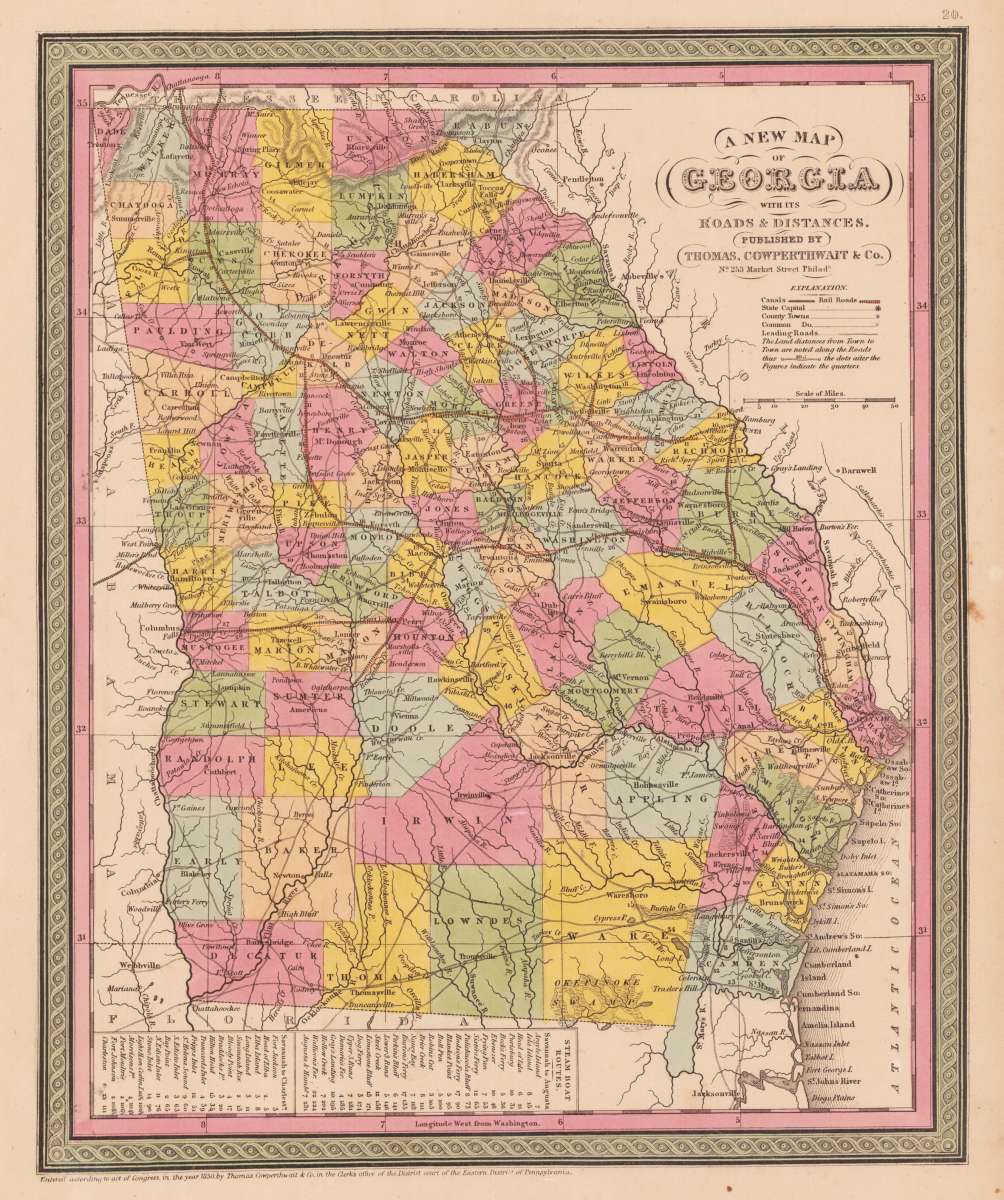
A new map of Georgia with its roads & distances. Published by Thomas, Cowperthwait & Co. No. 253 Market Street Philada.
Cowperthwait, Thomas & Co. – A new map of Georgia with its roads & distances. Publis... · Antique Map, Steel Engraving · 355 x 292mm · Samuel Augustus Mitche...
Eigenschaften
- Published: Philadelphia
- Published date: 1850
- Technique: Steel engraving, original color
- Category: Georgia
- Issue date: 1850
- Type: map
- Size: 355 by 292mm (14 by 11 inches).
- Stock number: 22045
- Condition: In excellent condition.
Article description
Article description
Steel Engraving, hand-colored in outline by Cowperthwait, Thomas & Co, published 1850 by Samuel Augustus Mitchell, Philadelphia. Image size: 355 by 292mm (14 by 11 inches). Thomas Cowperthwait & Co. was a Philadelphia-based map and atlas publisher active in the 1840s and 1850s. They produced regional and national atlases of the United States, drawing on the best available American survey sources. Their maps are finely engraved on steel with hand-applied outline coloring and offer a detailed mid-19th-century American perspective on states undergoing rapid settlement and development in the antebellum period. This map of Georgia centers our attention on the roads and railroads that crisscross the state. Political and topographical features are noted and color coded with elevation rendered by hachure. Steamboat routes and mileages are presented in tabular format in the lower left quadrant. The whole is engraved and colored in Mitchell's distinctive style with green border work and vivid pastels. In excellent condition.Cowperthwait, Thomas & Co. – A new map of Georgia with its roads & distances. Publis... · Antique Map, Steel Engraving · 355 x 292mm · Samuel Augustus Mitche...
You might also be interested in the following products
 Delaware and...
 Lithograph, color by Johnson & Ward, published 1862 by Johnson & Ward, New York. Image size: 400 by 320mm (15...
€90.00
 Vereinigte...
 Lithograph, hand-colored in outline by Bromme, Traugott, published 1855 by Hoffm.Verlagsbuchhandlung, Stuttgart....
€80.00
 (Vermont - New...
 Lithograph, hand-colored in outline by Smith, J. Calvin, published 1845 by Th. Fischer, Cassel. Image size: 370 by...
€295.00
 Gray's New...
 Lithograph, original color in outline by Gray, Frank, published 1884 by O.W. Gray & Son, Philadelphia. Image...
€95.00
Recently viewed products