The following products have been found matching your search "state": 110
Or did you mean: states | stat | United States | stated | southern states | statt | staten | Eastern United States
No results were found for the filter!
 Geographisch-statistische und historische Charte von Neuyork,
 Copper engraving, hand colored in outline when published. A decorative and detailed map of the state of New York....
€295.00
 Geographisch-statistische und historische Charte von Maine.
 Original copper engraving, hand colored in outline when published. This very informative antique map shows Main in...
€550.00
 Neueste Karte von Maryland und Delaware mit seinen Canaelen, Strassen und Entfernungen der Hauptpunkte. 1851
 Detailed map of the state of Maryland and Delaware. Original steel-engraving, contempory hand-colored in outline.
€177.00
 Partie Septentrionale de L´Etat de L' Eglise, contenant les Légations de Ferrare, de Bologne, et de Romagne, par...
 Copper engraving, hand colored in outline. A highly detailed map of the regions Ferrara, Bologna and Romagnola. The...
€445.00
 North America Sheet VI New York, Vermont, Maine, New Hampshire, Massachusetts, Connecticut, Rhode Island, and New...
 Original antique steel engraving, hand colored in outline when published. This North America map shows the east...
€95.00
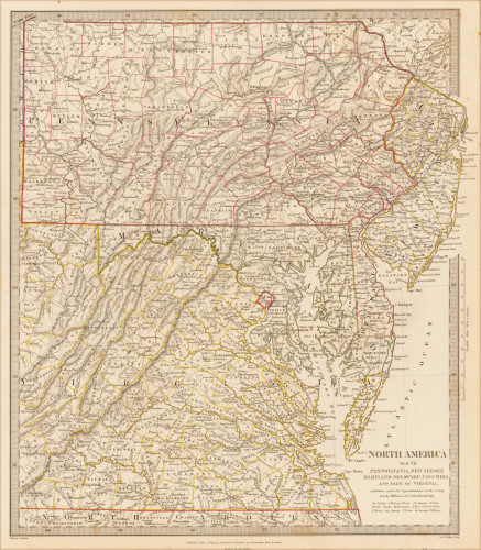
 North America Sheet VII Pennsylvania, New Jersey, Maryland, Delaware, Columbia and Part of Virginia.
 Original antique steel engraving, hand colored in outline when published. This North America map shows Pennsylvania,...
€60.00
 Mappa Geographica totius Insulae et Regni Siciliae cur graphio et impensis Matth. Seutteri, S.C.M.G. August.
 Original copper engraving hand colored in outline and wash when published. This beautiful old colored map depicts...
€475.00
 North America Sheet IX Parts of Missouri, Illinois and Indiana
 Original antique steel engraving, hand colored in outline when published. On this sheet of the SDUK North America...
€95.00
 Neueste Karte von Pennsylvania mit seinen Canaelen, Eisenbahnen & c. Nach den besten Quellen bearbeitet. 1845.
 Steel engraving, hand colored in outline and wash when published. Detailed map of the state of Pennsylvania. Inside...
€65.00
 A new map of Georgia with its roads & distances. Published by Thomas, Cowperthwait & Co. No. 253 Market...
 Steel engraving, hand colored in outline and wash. This map of Georgia centers our attention on the roads and...
€250.00
 Il Paese de' Selvaggi Outaucesi, e Kilistinesi intorno al Lago Superiore.
 Copper engraving, hand colored in outline when published. Published in Zatta's "Atlante Novissimo" as sheet I in his...
€495.00
 Pascaert van Groen-Landt Yslandt, Straet Davidts Ian Mayen Eylandt Terra Nova, hoemen de selvige van Hitlandt en de...
 Original antique copper engraving, uncolored as published. Detailed chart of the Northeastern part of Canada,...
€1,750.00

