Homann, Erben
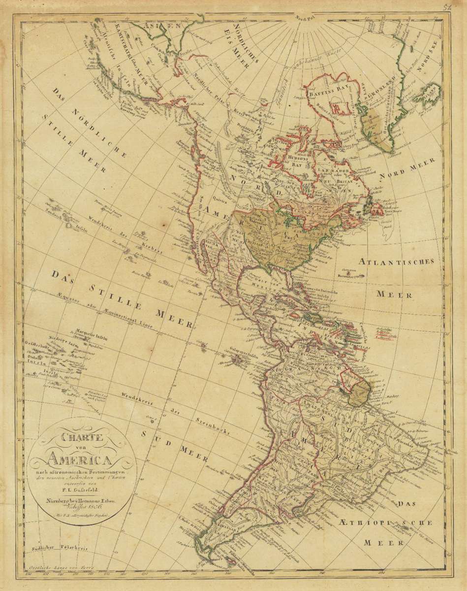
Charte von America nach astronomischen Bestimmungen, den neuesten Nachrichten und Charten entworfen von F. L....
Prices incl. VAT plus shipping costs
This item is sold. Please contact us if you are searching for this item.
- Published: Weimar
- Published date: 1806
- Issue date: 1806
- Technique: Copper engraving / Original color
- Type: map
- Category: Atlas America
- Size: 578 by 447mm (22¾ by 17½ inches).
- Stock number: 31559
- Condition: In good condition.
Article description
Copper engraving, hand colored in outline and wash when published. Detailed map of America, published in 1806 by Homann Erben. The map, which is not exactly to the north, shows the latest discoveries of the late 18th century. The details in Northwest Pacific are based on the Lewis & Clark Expedition. The coastline in the north is shown in dashed lines and labeled 'Probable coast' or 'completely unknown coast'. The Hawaiian Islands are referred to as 'Sandwich Islands', where the individual island names are based on early phonetic names. Between California and Hawaii are an archipelago with Spanish names, which can be found on various maps since the mid-18th century, and was not corrected until the early 19th century. Provenance: the map was acquired from the descents of the family of Parisel.
You might also be interested in the following products
 Westliche Halbkugel