Smith, J. Calvin
Arkansas No:9
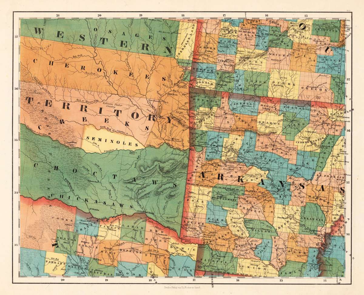
Smith, J. Calvin – Arkansas No:9 · Antique Map, Lithograph · 375 x 467mm · Theodor Fischer, Kassel 1855-60
Eigenschaften
- Published: Theodor Fischer , Kassel
- Published date: 1855
- Type: Antique Map, map
- Technique: Lithograph / Original color.
- Issue date: 1855-60
- Category: Western United States
- Size: 375 by 467mm (14 by 18 inches).
- Stock number: 24689
- Condition: In excellent condition. 375 by 467mm (14 by 18 inches).
Article description
Article description
Lithograph, original color in outline by Smith, J. Calvin, published 1855-60 by Theodor Fischer, Kassel. Image size: 375 by 467mm (14 by 18 inches). From Smith's multi-sheet Special-Karte — one of the most detailed and accurate mid-19th-century maps of the United States. John Calvin (J. Calvin) Smith (c.1809–1890) was an American surveyor, geographer, and engraver active in New York City from the 1840s. Working with partners including George Sherman (under the Sherman & Smith imprint, 1840–1853) and later in association with J.H. Colton, Smith produced some of the most accurate and widely used general-purpose maps of the United States of his era. His maps appeared in government publications, military surveys, and commercial atlases, and his multi-sheet Special-Karte der Vereinigten Staaten (published in a German-language edition) brought American cartographic standards to European audiences. Despite his prolific output and importance to American cartographic history, much of Smith's personal biography remains obscure. This very detailed map shows Arcansas, Parts of Missouri, Texas and the western Territory. In excellent condition.Smith, J. Calvin – Arkansas No:9 · Antique Map, Lithograph · 375 x 467mm · Theodor Fischer, Kassel 1855-60
You might also be interested in the following products
 Neueste Karte von...
 Steel Engraving, hand-colored in outline by Meyer, Joseph & Radefeld, Carl, published 1851 by Meyer,...
€95.00
 Amér. Sep. Partie...
 Lithograph, hand-colored in outline by Vandermaelen, Phillippe Marie, published 1825 by Phillippe Marie Vandermaelen,...
€195.00
Recently viewed products