Gray, Frank
Vermont
Gray, Frank – Vermont · Antique Map, Lithograph · 378 x 303mm · O.W. Gray & Son, Philadelphia 1884
Eigenschaften
- Published: O.W. Gray & Son , Philadelphia
- Published date: 1884
- Type: Antique Map, map
- Technique: Lithograph / Original color.
- Category: Vermont
- Issue date: 1884
- Size: 378 by 303mm (15 by 12 inches).
- Stock number: 19666
- Condition: In very good condition. 378 by 303mm (15 by 12 inches).
Article description
Article description
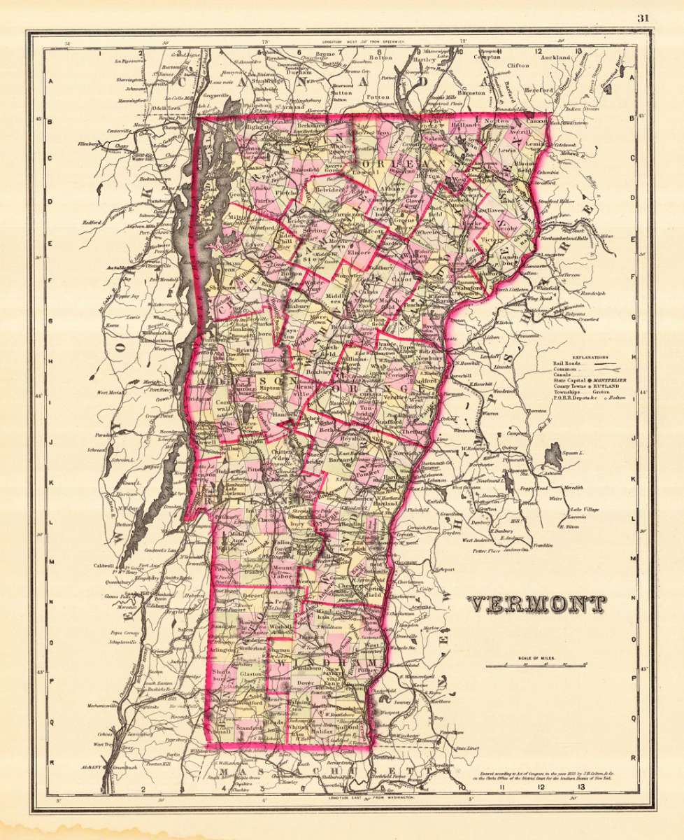
Lithograph, hand-colored in outline by Gray, Frank, published 1884 by O.W. Gray & Son, Philadelphia. Image size: 378 by 303mm (15 by 12 inches). From Gray's Atlas — one of the most important American commercial atlases of the post-Civil War era. Frank A. Gray was an American cartographer working in the 1870s and 1880s for the Philadelphia-based firm O.W. Gray & Son, one of the leading commercial map publishers of the post-Civil War United States. Founded by Ormando Willis Gray, a civil and topographical engineer, the firm produced Gray's Atlas of the United States and its many regional successors. Gray's National Atlas was among the most successful commercial atlas ventures of the 1870s and one of the last American atlases to employ hand-coloring. The state maps of the 1880s are noted for their excellent topographical detail, clear depiction of the expanding railroad network, and accurate county boundaries — invaluable primary sources for historians and sought-after collector pieces today. This antique map shows the state of Vermont in the United States. The map is divided up into its counties and provides detailed information on small place names, rivers, lakes, streets etc. On the right is a small explanation for this map. In very good condition.Gray, Frank – Vermont · Antique Map, Lithograph · 378 x 303mm · O.W. Gray & Son, Philadelphia 1884
You might also be interested in the following products
 Delaware and...
 Lithograph, color by Johnson & Ward, published 1862 by Johnson & Ward, New York. Image size: 400 by 320mm (15...
€90.00
 Vereinigte...
 Lithograph, hand-colored in outline by Bromme, Traugott, published 1855 by Hoffm.Verlagsbuchhandlung, Stuttgart....
€80.00
 (Vermont - New...
 Lithograph, hand-colored in outline by Smith, J. Calvin, published 1845 by Th. Fischer, Cassel. Image size: 370 by...
€295.00
 Gray's New...
 Lithograph, original color in outline by Gray, Frank, published 1884 by O.W. Gray & Son, Philadelphia. Image...
€95.00
Recently viewed products