Gray, Frank
Gray's Geological Map of the United States. By Prof. Charles H. Hitchcock. Ph. D.
Gray, Frank – Gray's Geological Map of the United States. By Prof. Ch... · Antique Map, Lithograph · 400 x 633mm · O.W. Gray & Son, Philadelphia 1882
Eigenschaften
- Published: Philadelphia
- Published date: 1882
- Technique: Lithograph / Original color.
- Category: United States
- Type: map
- Issue date: 1882
- Size: 400 by 633mm (15 by 25 inches).
- Stock number: 14716
- Condition: In excellent condition.
Article description
Article description
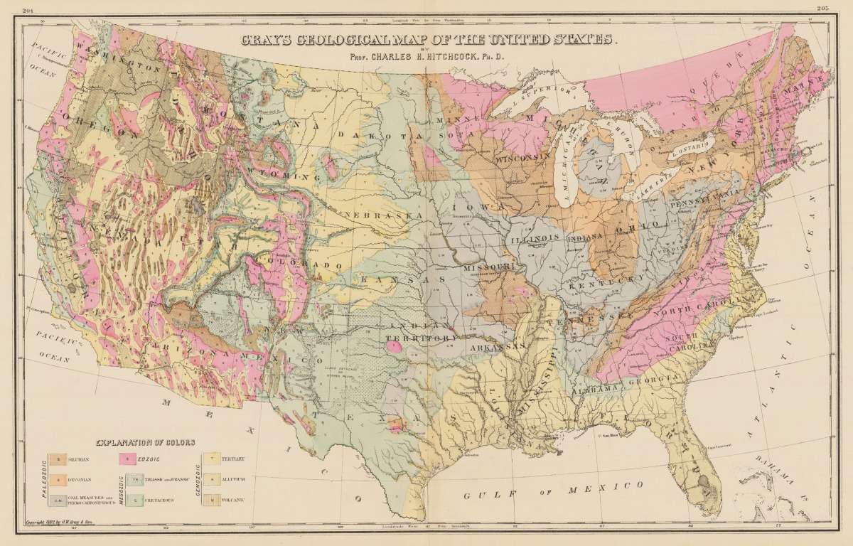
Lithograph, hand-colored in outline by Gray, Frank, published 1882 by O.W. Gray & Son, Philadelphia. Image size: 400 by 633mm (15 by 25 inches). From Gray's Atlas — one of the most important American commercial atlases of the post-Civil War era. Frank A. Gray was an American cartographer working in the 1870s and 1880s for the Philadelphia-based firm O.W. Gray & Son, one of the leading commercial map publishers of the post-Civil War United States. Founded by Ormando Willis Gray, a civil and topographical engineer, the firm produced Gray's Atlas of the United States and its many regional successors. Gray's National Atlas was among the most successful commercial atlas ventures of the 1870s and one of the last American atlases to employ hand-coloring. The state maps of the 1880s are noted for their excellent topographical detail, clear depiction of the expanding railroad network, and accurate county boundaries — invaluable primary sources for historians and sought-after collector pieces today. This beautifully colored antique map shows nine different geological classifications, each identified in a key at lower left. The title is engraved above the map. Dr. Charles H. Hichkock, professor of geology at the Dartmouth College has drawn this interesting geological map. In excellent condition.Gray, Frank – Gray's Geological Map of the United States. By Prof. Ch... · Antique Map, Lithograph · 400 x 633mm · O.W. Gray & Son, Philadelphia 1882
You might also be interested in the following products
 Amerique...
 Copper engraving, hand colored in outline and wash when published. Fine engraved map of the state of North America...
€480.00
 America...
 Copper engraving, hand colored in wash when published. This map of North America published by G. Tasso in Venice is...
€475.00
 Bergsystem von...
 Original steel-engraving, hand colored in outline, when published. Detailed fine map of North-America s mountain...
€140.00
 Bergsystem von...
 Original steel-engraving, hand colored in outline, when published. Detailed fine map of North-America s mountain...
€145.00
Recently viewed products