Petermann, A.
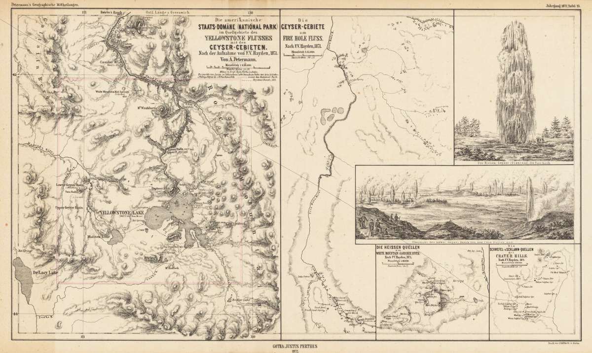
Die amerikanische Staats-Domäne (National Park) im Quellgebiete des Yellowstone Flusses mit den Ceyser-Gebieten. -...
€215.00
Prices incl. VAT plus shipping costs
This item is sold. Please contact us if you are searching for this item.
Eigenschaften
- Published: Gotha
- Published date: 1872
- Technique: Lithograph / uncolored
- Issue date: 1872
- Type: map
- Category: Western United States & California
- Size: 247 by 425mm (9¾ by 16¾ inches).
- Stock number: 26563
- Condition: In excellent condition. The map was originally published folded, so that the old folds are still slightly visible.
Article description
Article description
Lithograph, uncolored as published. This map is one of the earliest available regional maps of Yellowstone. It shows the rivers and geysers in the Yellowstone Park. llustratet after the recent surveying work by F.V. Hayden.You might also be interested in the following products
 Views from Mt....
 Lithograph by Holmes, William Henry, published 1880 by Julius Bien & Co, New York. Image size: 480 by 765mm (19...
€195.00
 Amér. Sep. Ile De...
 Lithograph, hand-colored in outline by Vandermaelen, Phillippe Marie, published 1825 by Brussels. Image size: 487 by...
€84.00
 Amer. Sep. Grand...
 Lithograph, hand-colored in outline by Vandermaelen, Phillippe Marie, published 1825 by Brussels. Image size: 478 by...
€128.00
 Amèr. Sep. Partie...
 Lithograph, hand-colored in outline by Vandermaelen, Phillippe Marie, published 1827 by Brussels. Image size: 463 by...
€800.00
Recently viewed products