Blondeau
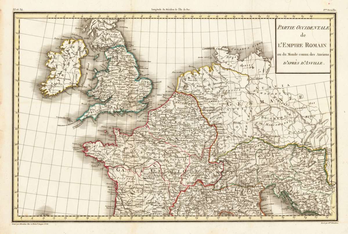
Partie Occidentale de L'Empire Romain ou du Monde connu des Anciens d'Après d'Anville.
Eigenschaften
- Published: Lapie , Paris
- Published date: 1797
- Technique: Copper engraving / Original color.
- Type: Antique Map, map
- Issue date: 1797
- Category: Western Roman Empire
- Size: 350 by 543mm (13¾ by 21½ inches).
- Stock number: 23091
- Condition: In excellent condition. 350 by 543mm (13¾ by 21½ inches).
Article description
Article description
Copper engraving, hand colored in outline when published. Interesting map of the Western Roman Empire showing England, France, Switzerland and Northern Italy. The map is based on the cartographic source by d' Anville.You might also be interested in the following products
 Li Regni D'...
 Copper engraving, in contemporary original color in outline. Published in Zatta's "Atlante Novissimo"....
€245.00
 Neueste Karte von...
 Steelengraving, handcolored in outline when published. Detailled map of Great Britain and Ireland with many...
€80.00
 General Carte von...
 Original antique copper engraving, hand colored in outline and wash, when published. Detailled map of the British...
€195.00
 Carte des Grandes...
 Copper-engraving, handcolored in outline, when published. Detailed map by the French cartographer Sr. Robert de...
€350.00
Recently viewed products