The following products have been found matching your search "bays": 45
No results were found for the filter!
 Neu-Seeland (New Zealand) im Maassstabe 1:5.000.000. - Von A. Petermann.
 Lithograph, handcolored in outline when published. Three maps on one sheet. The first map shows New Zealand with the...
€223.00
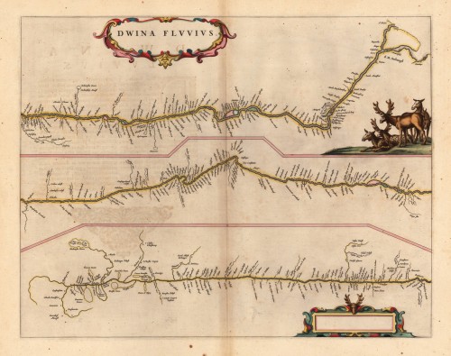
 Dwina Fluuius.
 Original antique copper engraving, hand colored in outline and wash when published. The map is divided into three...
€300.00
 Eyland Mayo - Aussicht des Eylandes S. Jago od. St. Jacob und der Stadt St. Jago od. Ribeyro Grande. - Der Hafen...
 Copper engraving, uncolored as published. Along the coastlines engraved anchor places, as well names of the bays,...
€45.00
 Karte von der westlichen Küste von Africa von dem weißen Vorgebürge bis nach Tanit.
 Copper engraving, uncolored as published. A very nice and detailed map, which shows the Bay of Arguim. In the lower...
€50.00
 Carte des Costes de Portugal et de Partie d`Espagne, de puis le Cap de Finisterre Jusques au Detroit de Gibraltar....
 Copper engraving, uncolored as published. A fine example of a strong impression of this large map. This issue is...
€1,200.00
 Accurate Vorstellung der berühmten Meers-Enge bey Gibraltar mit denen herumliegenden See-Haefen und Vestungen so wohl...
 Original antique copper engraving in full contemporary handcolor in wash and outline when published. This decorative...
€445.00
 Charte von der Mündung des Mississipi. Weimar, im Verlage des Landes Indust. Compt. 1805.
 Copper engraving, uncolored as published. A very nice and quite detailed antique map, which shows the mouth of the...
€268.00
 Süd Carolina. Nach des Gouverneurs von Carolina, J. Drayton´s Charte (1803) reduciert.
 Copper engraving, uncolored as published. This interesting antique map shows South Carolina and its cartographic...
€245.00
 (West Canada, Lake Huron & Lake Ontario)
 Lithograph, original color in outline and wash. This decorative map shows the region from West Canada, Ottawa River...
€245.00
 La Baja d' Hudson Terra di Labrador e Groenlandia con le Isole Adiacenti di nouva Projezione - Venezia 1778...
 Copper engraving, in contemporary original color in outline. Published in Zatta's "Atlante Novissimo"....
€335.00
 Neu-Seeland (New Zealand) im Masstabe 1:5.000.000. - Von A. Petermann
 Lithograph, original color as published. Detailled and exact map of New Zealand with the Northern and Southern...
€223.00
 Der Isthmus von Panama.
 Lithograph, original hand color in outline. An interesting and detailed old map of the Isthmus of Panama from the...
€132.00

