The following products have been found matching your search "london seutter": 69
Or did you mean: london | map of london | london map | seutter | seutte | seuttero | seutteri | seutters
No results were found for the filter!
 Carte de la Prevoste et Vicomte de Paris - Dreßée fur ungrand nombre de Memoires particudiers aßujettis aux...
 Copper-engraving, handcolored in outline and wash , when published. Decorative map by the famous cartographer...
€175.00
 Gallia Coneinata ad maginum numer: mappau: partiu manuscript velipreßan: Nixta genumun situm locon eteollatarum cum...
 Copper engraving, hand colored in outline and wash.
€95.00
 Mappa Geographica in qua Ducatus Lotheringiae et Bar ut et Episcopatuum Metens. Tullens. Ver Dunens. Territoria,...
 Copper engraving, hand colored in outline and wash.
€75.00
 Ducatus Mediolanensis cum adjacentibus Principat et Dominiis acuratissime delineatus cura et sumtibus Matthaei...
 Copper engraving, hand colored in outline and wash.
€295.00
 Greece or The South Part of Turkey in Europe. By H. Moll Geographer.
 Copperengraving, uncolored as published. This antique map shows the Sout part of Greece. Inside the map are many...
€175.00
 The N.E. Part of Germany Containing the Dominions of the Electors of Brandenburg and Saxony, the Dutchy of...
 Copper engraving, uncolored as published. Small and decorative map of the northeastern part of Germany mainly...
€145.00
 France. By T. Starling.
 Steel engraving, hand colored in outline and wash when published. The map shows detailed France divided up into its...
€15.00
 Plan of the City and Harbour of Marseille.
 Attractive town plan with decorative cartouche from 'A New Geographical Dictionary: containing a full and...
€50.00
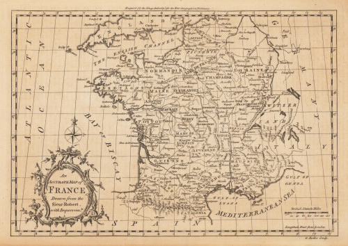
 An Accurate Map of France Drawn from the Sieur Robert, with Improvemts.
 Original antique copper engraving, uncolored. Published in London and engraved for the 'New Geographical...
€80.00
 Elegantissimus a parti Orientali Oenipontis prospectus.
 Original antique hand colored copper engraving, published in volume V of the townbooks "Civitates Orbis Terrarum" by...
€850.00
 Artesia. Iacobo Surhonio Montano auctore.
 Original antique copper engraving, published in the first Spanish edition of the 'Theatrum Orbis Terrarum'...
€295.00
 Insularum Archipelagi Septentrionalis seu Maris Aegaei Accurata Delinatio Auctore I. Laurenbergio.
 Original antique copper engraving, hand colored in outline when published. The map was published in Joan....
€495.00

