United States
No results were found for the filter!
 North America Sheet XI Parts of North and South Carolina
 Steel engraving, hand colored in outline when published. This antique map shows the East Coast with North and South...
€110.00
 North America Sheet IX Parts of Missouri, Illinois and Indiana
 Original antique steel engraving, hand colored in outline when published. On this sheet of the SDUK North America are...
€95.00
 Gray's Geological Map of the United States. By Prof. Charles H. Hitchcock. Ph. D.
 Original hand colored lithograph. This beautifully colored antique map shows nine different geological...
€195.00
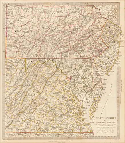
 North America Sheet VII Pennsylvania, New Jersey, Maryland, Delaware, Columbia and Part of Virginia.
 Original antique steel engraving, hand colored in outline when published. This North America map shows Pennsylvania,...
€60.00
 North America Sheet VI New York, Vermont, Maine, New Hampshire, Massachusetts, Connecticut, Rhode Island, and New...
 Original antique steel engraving, hand colored in outline when published. This North America map shows the east coast...
€95.00
 North America Sheet XIII Parts of Louisiana, Arkansas, Mississippi, Alabama & Florida.
 Original antique steel engraving, hand colored in outline when published. This North America map shows Parts of...
€110.00
 North America Index Map to Canada and the United States
 Original antique steel engraving, hand colored in outline when published. This North America map shows the East coast...
€65.00
 North America Sheet V The North West and Michigan Territories
 Original antique steel engraving, hand colored in outline when published. This detailed antique map shows the North...
€195.00
 Plan of Peekskill Westchester Co. N. Y.
 Original antique lithograph, original color in outline and wash. Published in Beer's famous county atlas "Atlas of...
€250.00
 Plan of Yonkers Town of Yonkers Westchester Co. N. Y.
 Original antique lithograph, original color in outline and wash. Published in Beer's famous county atlas "Atlas of...
€250.00
 Fishkill on the Matteawan Hudson
 Original antique lithograph, original color in outline and wash. Published in Beer's famous county atlas "Atlas of...
€300.00
 Singsing
 Original antique lithograph, original color in outline and wash. Published in Beer's famous county atlas...
€250.00
Recently viewed products

