The following products have been found matching your search "baye": 31
No results were found for the filter!
 Pascaarte vande Norder Zee custen van America. Vande West-hoeck van Ysland doorde Straet Davis en Hudson, tot aen...
 Original antique copper engraving, uncolored as published. A highly detailed and decorative sea chart of Greenland...
€1,100.01
 America Settentrionale disegnata dopo i viaggi di Lewis, Clarke, Parry e Franklin e dall Atl. di J. A. Buchon; per l...
 Copper engraving, hand colored in wash when published. This map of North America published by G. Tasso in Venice is...
€475.00
 Karte von den Nord-Westlichen Theilen von America nach Middeltons und Ellis Reisen im J. 1742 und 1746 um einen Weg...
 Original old copper engraving, uncolored as published. This very decorative antique map shows the Hudson Bay Area...
€84.00
 Ora Baiana et Puteolana calidis fontibus ...
 Original antique copper engraving, hand colored in outline and wash when published. Decorativ map of the Bay of...
€175.00
 Paskaart Van de Kust van Maroca Beginnende Van Larache. tot aan C. Cantin. Met syn Diepte en Droogte dus-ver...
 Original antique copper engraving, uncolored as published. Decorative early sea chart, orientated with the North to...
€395.00
 Amér.Sep. Embouchures Du Mississipi. No.61.
 Lithograph, original hand colored in outline when published. This highly decorative map shows the region of the...
€177.00
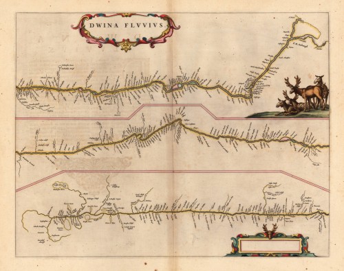
 Dwina Fluuius.
 Original antique copper engraving, hand colored in outline and wash when published. The map is divided into three...
€300.00
 Karte von der westlichen Küste von Africa von dem weißen Vorgebürge bis nach Tanit.
 Copper engraving, uncolored as published. A very nice and detailed map, which shows the Bay of Arguim. In the lower...
€50.00
 Carte des Costes de Portugal et de Partie d`Espagne, de puis le Cap de Finisterre Jusques au Detroit de Gibraltar....
 Copper engraving, uncolored as published. A fine example of a strong impression of this large map. This issue is...
€1,200.00
 Accurate Vorstellung der berühmten Meers-Enge bey Gibraltar mit denen herumliegenden See-Haefen und Vestungen so wohl...
 Original antique copper engraving in full contemporary handcolor in wash and outline when published. This decorative...
€445.00
 Charte von der Mündung des Mississipi. Weimar, im Verlage des Landes Indust. Compt. 1805.
 Copper engraving, uncolored as published. A very nice and quite detailed antique map, which shows the mouth of the...
€268.00
 Süd Carolina. Nach des Gouverneurs von Carolina, J. Drayton´s Charte (1803) reduciert.
 Copper engraving, uncolored as published. This interesting antique map shows South Carolina and its cartographic...
€245.00

