The following products have been found matching your search "sea charts": 72
No results were found for the filter!
 Nieuwe Zeekaart Van t' Eerste Gedeelt Van t' Canaal Tufschen Engeland en Vrankryk ... The New Sea map of...
 Original antique copper engraving, uncolored as published. Decorative hand colored seachart showing the English...
€495.00
 Carte Nouvelle de la Mer Mediterranee où sont Exactement Remarques tous les Ports, Golfes, Rochers, Bancs de Sable...
 Original copper engraving, hand colored in outline and partial heightened in gold in the period, when published in...
€28,000.00
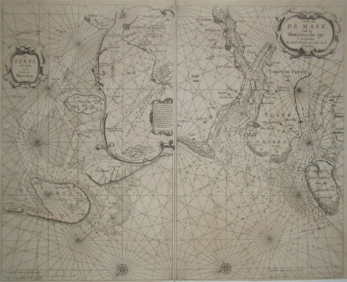
 a. De Texel Stroom en de Gaten van Marsdiep. Inset (c. 24 x 12cm) : Caarte vande Rede en Haven van Medenblick hoemen...
 Two sea-charts on one doublepage. The left one is showing Medenblick, Texel and Wieringen. Additional there is a...
€1,250.00
 Pomeraniae Ducatus.
 Original antique copper engraving, uncolored. Published in the first Cloppenburgh edition of Gerhard Mercator's...
€175.00
 Nieuwe Paskaert Van de Zoute Eylanden Nieuwe Paskaert Van de Zoute Eylanden,
 Original antique copper engraving, uncolored as published. This sea chart shows Gualate. In the upper right corner...
€545.00
 Nieuwe Paskaert Van de Zoute Eylanden Nieuwe Paskaert Van de Zoute Eylanden,
 Original antique copper engraving, uncolored as published. The Dutch firm and printing house van Keulen was one of...
€495.00
 Barbariae et Guineae aritimi á Freto Gibraltar ad Fluvium Gambiae cum Insulis Salfis Flandricis et Canaricis L. Renard.
 Copper-engraving, hand colored in outline and wash when published. Large and decorative sea chart showing West...
€916.50
 Insulae de Cabo Verde, Olim Hesperides, Sive Gorgades: Belgice de Zoute Eylanden.
 Original copper engraving, uncolored published. Double page sea chart covering detailed the Cap Verde Islands in the...
€590.00
 West Indies Lesser Antilles or Caribbee 1st Guadeloupe to Trinidad compiled from the last Government surveys
 Original antique steel engraving. Admiralty chart, designed as an aid to navigation at sea. Chart Number 956,...
€550.00
 Guadeloupe
 Original antique steel engraving. Large sea chart of Guadeloupe and its surroundings with 8 inset maps of the...
€550.00
 Pascaert van Groen-Landt Yslandt, Straet Davidts Ian Mayen Eylandt Terra Nova, hoemen de selvige van Hitlandt en de...
 Original antique copper engraving, uncolored as published. Detailed chart of the Northeastern part of Canada,...
€1,750.00
 Pascaarte vande Norder Zee custen van America. Vande West-hoeck van Ysland doorde Straet Davis en Hudson, tot aen...
 Original antique copper engraving, uncolored as published. A highly detailed and decorative sea chart of Greenland...
€1,100.01

